Papamoa Hills Walk – A Complete Guide
Looking for a spot to get away from crowds and take a quiet walk in the countryside? Papamoa Hills offers several walking tracks and unblocked views of the Bay of Plenty.
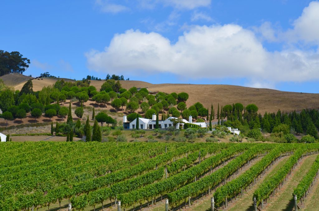
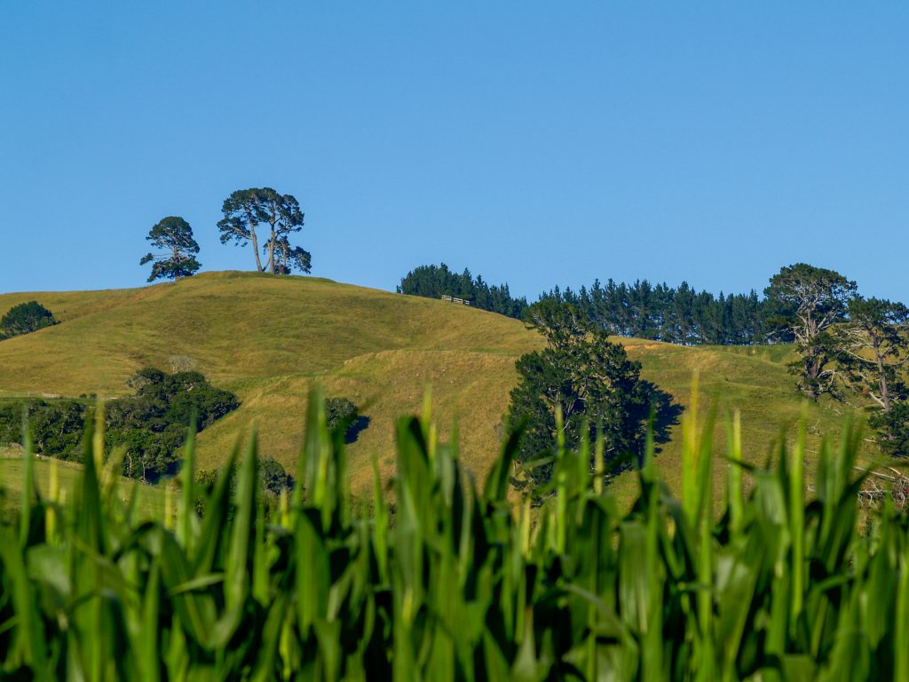
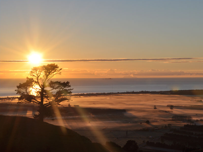
The Papamoa Hills walk is a hike over rolling hills and pasture land, with stunning views of the Western Bay of Plenty’s coastline and towns. It traverses an active farm, so you’ll see sheep and cattle roaming along the way. Most of the paths are well packed and moderately traveled. While it’s not a challenging hike, it is moderately strenuous and does cover some steep terrain that will get your blood pumping.
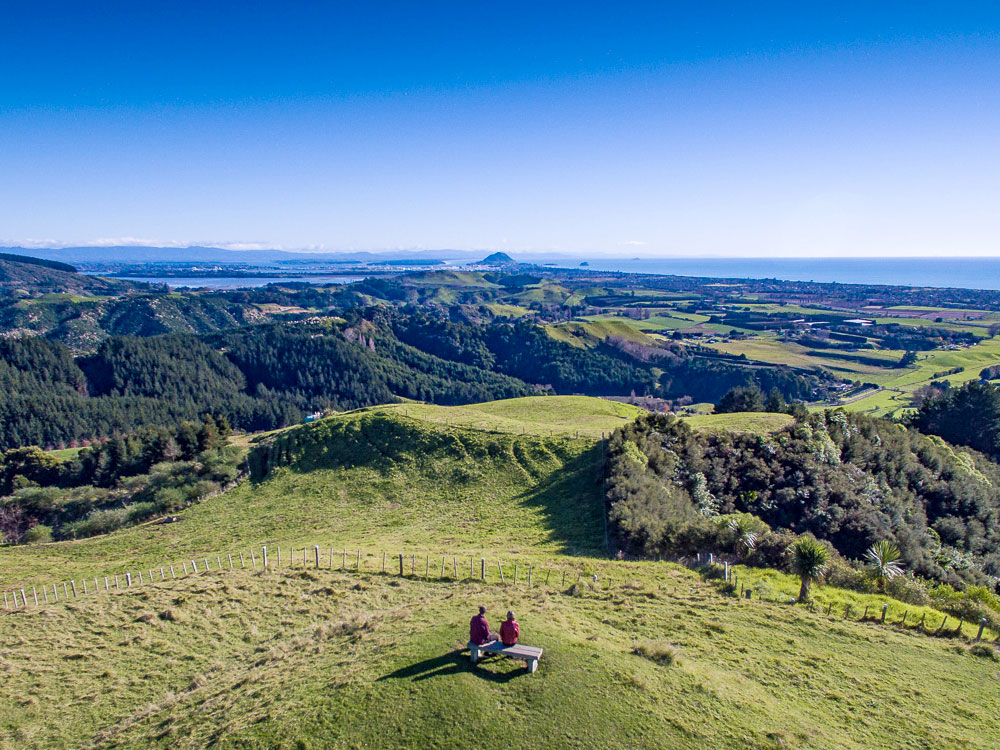
The site’s main draw is the unblocked view from the hill as you walk the footpaths along the ridgeline. Except for the first few meters of the trail, no trees block your view of the sea and countryside.
The site was important to several pre-European cultures, and there remain several archaeological features. Three iwi (Maori tribes), the Ngaiterangi, Waitaha A Hei, and Ngati Pukenga, built seven pa sites. A pa is an earthen terraced fort. Most of the activity dates to about 1650 AD or earlier.
The site was significant due to its strategic position and height above the surrounding terrain. From here, tribes could control access to the coast to Maketu and Tauranga Moana.
How to Get to Papamoa Hills

The Papamoa Hills Regional Park is located in the Western Bay of Plenty on the North Island of New Zealand. Situated near the town of Te Puke (check our one of our most popular Te Puke accommodations), it’s about 20 kilometers from Tauranga, 65 kilometers from Rotorua, and 80 kilometers from Whakatane. If you’re driving from Auckland, it will take you a little over three hours.
The main entrance to the trails is located off of Poplar Lane, located off of the Te Puke Highway, about 17 kilometers south of Tauranga. The parking area is to the right, before the entrance gate to the quarry. Use caution along Poplar Lane as it is frequently used by quarry trucks.
Unfortunately, there are no public transport or walking options to get to Papamoa Hills. It’s too far from city centers, and the roads have no footpaths. To access this regional park, you’ll need to have a car.
Hiking from Summerhill Recreation Farm
One of the footpaths in Papamoa Hills crosses the ridgeline entirely and takes you to Summerhill Recreation Farm, located off of Reid Road, a little bit closer to Tauranga. The total hiking distance between the Summerhill Recreation Farm and the car park area on Poplar Lane is about eight kilometers. Summerhill is a 126-hectare park with dozens of hiking and mountain biking trails.
Parking
There is a small car park on Poplar Lane. It is open from 6:30 am to 7:00 pm in the winter, and from 6:30 am to 9:00 pm in the summer. The car park is locked overnight.
Facilities
Besides walking trails, stunning scenery, and an occasional sheep, you won’t find much at Papamoa Hills Regional Park. There are lavatories in the parking area near the trailhead, but you must take out all rubbish with you. Remember to bring drinking water.
You’ll also find several informational signs with details on the track routes and distances at the trailhead. There are also educational signs about the history of the park and its cultural significance.
Track Difficulty
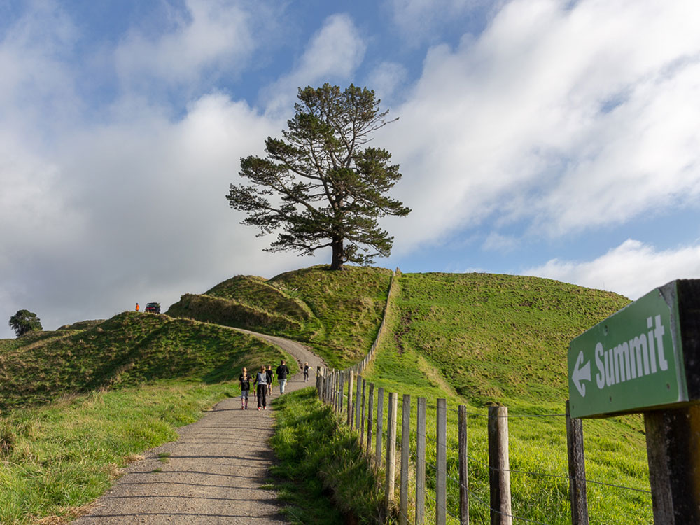
There are several different trails at Papamoa Hills, so it’s good to plan out your track before setting out. The most trafficked path leads from the car park to the summit. It begins with shallow stairs and progresses onto various inclines that follow the hill’s ridgelines.
Some paths branch out and lead to the various pa sites in the park. There are seven sites in the park, and each path leads to a spot with a fantastic view.
Conditions
Most of the walking trails are well-kept, but good walking shoes are recommended. In some sections, it is quite steep. A reasonable level of fitness is required to make it up some of the inclines.
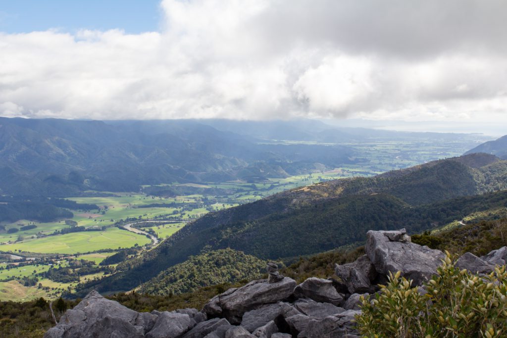
The track rises steeply through the bush and pine forest. From there, it traverses open farmland and pastures with gorgeous views of the coast. You’ll be crossing open fields and walking along ridgetops. Throughout the track, you’ll gain 192 meters (629 feet); it’s rated as a moderate hike.
Along the way, you’ll pass a few benches where you can relax and rest while enjoying the stunning scenery.
Distance
From the Poplar Lane car park to the trig station on the summit is about a one hour hike. This is an out-and-back trail, so you’ll be retracing your steps to get back to your car. In total, it’s 3.7 kilometers (2.3 miles) from the car park to the summit and back.
According to the information at the trailhead, the tracks are divided into six possible paths you could take during your trek. It’s a bit confusing, though, since the paths interconnect in various ways. All of the trails come after you transit at least half of the Summit Track. It’s best to study the map carefully, and maybe take a picture with your phone when you get there.
- Karangaumu Summit Track—1.8 km, 45 minutes one way
- Te Rae o Papamoa Track—1.8 km, 30 minutes one way
- Valley Track—1.2 km, 30 minutes one way
- Puriri Track—800m, 20 minutes one way
- Maraeroa Track—2.3km, 60 minutes one way
- To Summerhill Recreation Farm—1.4 km, 40 minutes one way
Unique Features
1. Climb to the Top
Papamoa Hill stands at 224 meters above sea level and is the apex of the hike. A Trig Station is on top of the hill. This site is set up with known coordinates and elevation that all other official measurements for the area are taken from. In other parts of the world, this is known as a triangulation station or a trigonometrical point. The trig station at Papamoa Hills has an easily identifiable black and white tripod tower.
But the hill’s summit is just one part of the journey. The walk up from the bottom is one to be savored. You’ll pass through a wooded forest and then into pasture land. It’s quiet and serene, away from the busy city and out in the fresh air. This is New Zealand hiking at its best.
2. Stunning Views
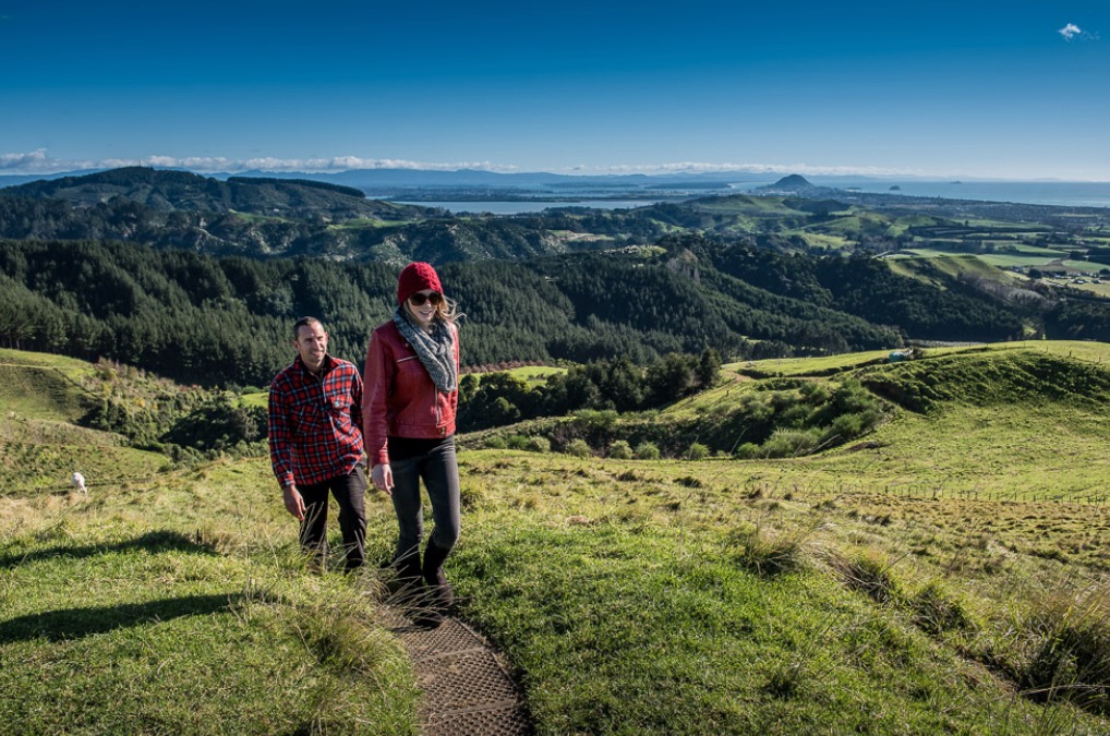
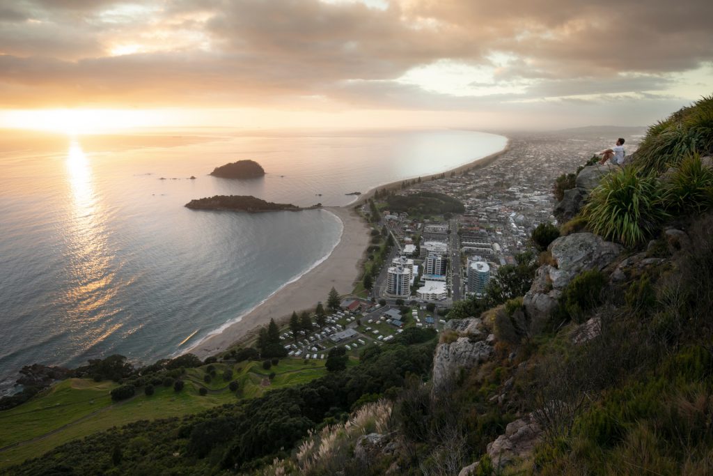
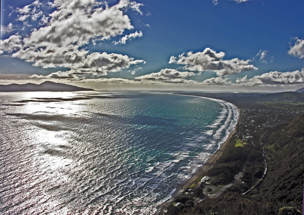
Of course, what sets the hikes at Papamoa Hill apart is the outstanding scenery. The hill stands alone, with unobscured views out to the Bay of Plenty. The first section of the track takes you up the inland side of the hill, so for the first part of your hike, you’ll be enjoying views of the pastoral countryside.
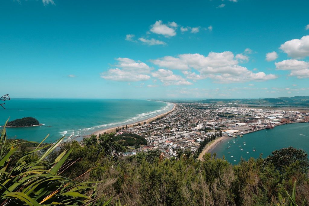
Once near the summit, you’ll start seeing more panoramic views of the coast. At various locations along the trails, you can see Papamoa Beach and the Papamoa Coastal Reserve. You can also spot offshore Motiti, Mayor, and White Islands.
3. Cultural Heritage Sites
The hills have at least seven known Maori pa sites. These were fortified settlements built into the mountain. The tribes used the natural slope of the hill and built it up with palisades and terraces. The tribes used the pa to safeguard stores of food and water, as well as small plantations. One iwi (tribe) may have overseen several pa, with their primary residence and farming sites in between them. Pa were important symbols of the iwi’s mana, or power and prestige.
Helpful Tips for the Papamoa Hills Walk
- While the trails are well worn, good shoes are essential as there is loose gravel over steep terrain.
- There are no dogs, camping, bikes, horse, or fires allowed in Papamoa Hills.
- Remember, this is a rubbish free park with no bins. Please carry out everything you bring with you.
- There’s little shade along the route, so sunscreen and hats are essential.
- Bring a bottle of water because there are no fountains or facilities at all and it can get quite hot on some days.
- Papamoa Hills is an operational farm with livestock. Leave all gates as you found them, open or closed.
Before You Go
Papamoa Hills is a beautiful and peaceful walk that is not quite as busy as some more popular sites. It’s the perfect place to get a little exercise and fresh air, and with many different paths, you can spend many hours exploring these hills.
While exploring New Zealand’s North Island and all of the sights it offers, check out Bachcare Holiday Homes for the perfect getaway cottage to meet your needs.